Featured Youtube Video
My Latest Instagram Post
Instagram did not return a 200.Categories
- About Me (3)
- Adoptable Pups (1)
- All Things Ava (1)
- Aviation Weather (8)
- Beauty & Fashion (2)
- Business of Aviation (2)
- Child Sexual Abuse (2)
- Cross Country Flying (8)
- Dangerous Drugs (4)
- Dog Rescue (3)
- FAA Dispatcher Exam Prep (3)
- Favorite Things (7)
- Flying Lessons (25)
- Grieving (1)
- Holiday Fun (2)
- Home Decor (2)
- Hotel Reviews (1)
- IFR Written Test (3)
- Inspiration (4)
- Instrument Checkride Preparation (5)
- Legal Marketing (7)
- Life with a Toddler (6)
- Motivation (3)
- Movies (2)
- Music (3)
- Personal Injury Law (6)
- Private Pilot Exam (12)
- Recipes (2)
- Song Meanings (1)
- Taylor Swift (1)
- The Bachelor (1)
- VOR (1)
- Work Travel (1)
Recent Posts
- Save Energy and Save Money ~ Get $10 When you Sign up with OhmConnect!
- 2018 Review: Sheffield School of Aeronautics – Dispatch School in Fort Lauderdale
- Kitchen Table Sanding & Refinishing Project – Dewalt Sander and Minwax Stain
- Pokolodi Lodge Review – Aspen Snowmass, CO
- Aircraft Dispatcher Exam: Lesson Two (Aerodynamics and Aircraft Systems) – Wing Lift Devices
Categories
- About Me
- Adoptable Pups
- Aerodynamics and Aircraft Systems
- All Things Ava
- Aviation Weather
- Beauty & Fashion
- Business of Aviation
- Child Sexual Abuse
- Cross Country Flying
- Dangerous Drugs
- Dog Rescue
- FAA Dispatcher Exam Prep
- Favorite Things
- Flying Lessons
- Grieving
- Holiday Fun
- Home Decor
- Hotel Reviews
- IFR Written Test
- Inspiration
- Instrument Checkride Preparation
- Legal Marketing
- Life with a Toddler
- Motivation
- Movies
- Music
- Personal Injury Law
- Private Pilot Exam
- Recipes
- San Bernardino City Shelter
- Song Meanings
- Taylor Swift
- The Bachelor
- VOR
- Wing Lift Devices
- Work Travel
Instrument Checkride Prep: Reading and Interpreting the METAR
I’m taking the instrument check ride next month and I’m going to be blogging nightly on different topic in preparation for all of the stuff I think will come up on the oral part. I am preparing for lots of aviation weather talk, so at least the next week will be over those topics. I will have to explain things like the difference between a stable and an unstable atmosphere, what standard temperature and pressure values are, and the two basic ways that fog may form.
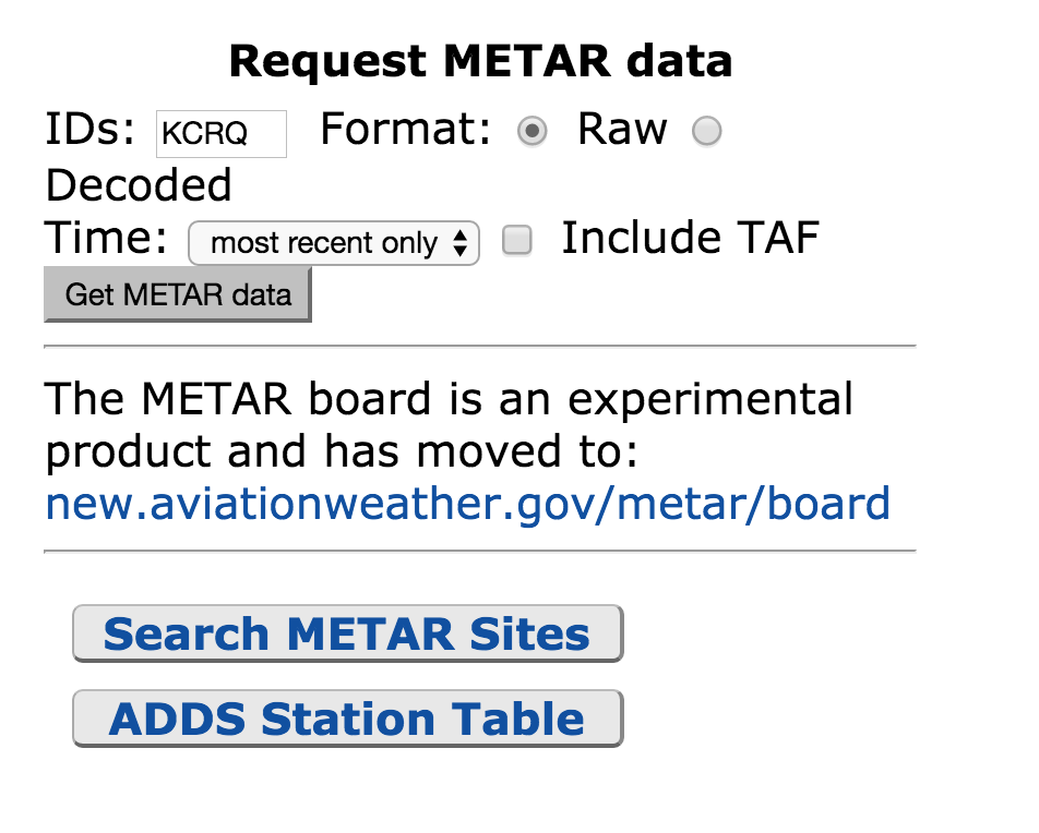
One very basic thing I will have to do is hop on aviationweather.gov and read and interpret a METAR. The first thing I will do is going to aviationweather.gov and click on METAR – it’s in the upper left hand corner of the website. Then I will scroll down to near the bottom of the page – on the right, where it says “Request Metar Data”, and I’ll type in the identifier of my airport – in this case KCRQ.
The METAR reads: Data at: 0358 UTC 23 Mar 2016 KCRQ 230353Z AUTO VRB03KT 10SM CLR 15/10 A3004 RMK AO2 SLP169 T01500100
Here’s how I’d read this: Airport is KCRQ, Carlsbad, CA Time – 23nd of March at 03:58 Zulu Time. I convert the time and it’s the 22nd of march at 20:58 Pacific Daylight time. The AUTO, when it appears just after the time group, means that the observation is from an automated station. Winds are light and variable at 3 knots, visibility is 10 or more statute miles, sky is clear, Temperature is 15 degrees, Dew Point is 10 degrees. Remarks: A02 means the station has a precipitation discriminator. SLP stands for Sea Level Pressure, which is another measure of atmospheric pressure. The Last digits that start with a “T” are the he hourly air and dewpoint temperatures to the nearest 1/10 C degree.
Tomorrow night I think I will review the Winds and Temperature aloft chart, and what valuable information can be determined on there, like the most favorable altitude, areas of possible icing, temperature inversions, and turbulence.


