Featured Youtube Video
My Latest Instagram Post
Instagram did not return a 200.Categories
- About Me (3)
- Adoptable Pups (1)
- All Things Ava (1)
- Aviation Weather (8)
- Beauty & Fashion (2)
- Business of Aviation (2)
- Child Sexual Abuse (2)
- Cross Country Flying (8)
- Dangerous Drugs (4)
- Dog Rescue (3)
- FAA Dispatcher Exam Prep (3)
- Favorite Things (7)
- Flying Lessons (25)
- Grieving (1)
- Holiday Fun (2)
- Home Decor (2)
- Hotel Reviews (1)
- IFR Written Test (3)
- Inspiration (4)
- Instrument Checkride Preparation (5)
- Legal Marketing (7)
- Life with a Toddler (6)
- Motivation (3)
- Movies (2)
- Music (3)
- Personal Injury Law (6)
- Private Pilot Exam (12)
- Recipes (2)
- Song Meanings (1)
- Taylor Swift (1)
- The Bachelor (1)
- VOR (1)
- Work Travel (1)
Recent Posts
- Save Energy and Save Money ~ Get $10 When you Sign up with OhmConnect!
- 2018 Review: Sheffield School of Aeronautics – Dispatch School in Fort Lauderdale
- Kitchen Table Sanding & Refinishing Project – Dewalt Sander and Minwax Stain
- Pokolodi Lodge Review – Aspen Snowmass, CO
- Aircraft Dispatcher Exam: Lesson Two (Aerodynamics and Aircraft Systems) – Wing Lift Devices
| M | T | W | T | F | S | S |
|---|---|---|---|---|---|---|
| « Jun | ||||||
| 1 | 2 | 3 | 4 | 5 | 6 | |
| 7 | 8 | 9 | 10 | 11 | 12 | 13 |
| 14 | 15 | 16 | 17 | 18 | 19 | 20 |
| 21 | 22 | 23 | 24 | 25 | 26 | 27 |
| 28 | 29 | 30 | ||||
Categories
- About Me
- Adoptable Pups
- Aerodynamics and Aircraft Systems
- All Things Ava
- Aviation Weather
- Beauty & Fashion
- Business of Aviation
- Child Sexual Abuse
- Cross Country Flying
- Dangerous Drugs
- Dog Rescue
- FAA Dispatcher Exam Prep
- Favorite Things
- Flying Lessons
- Grieving
- Holiday Fun
- Home Decor
- Hotel Reviews
- IFR Written Test
- Inspiration
- Instrument Checkride Preparation
- Legal Marketing
- Life with a Toddler
- Motivation
- Movies
- Music
- Personal Injury Law
- Private Pilot Exam
- Recipes
- San Bernardino City Shelter
- Song Meanings
- Taylor Swift
- The Bachelor
- VOR
- Wing Lift Devices
- Work Travel
First Cross Country Flight Video – Carlsbad to Lancaster
For those interested, here is video from part of yesterday’s cross country flight, – my first ever – from the takeoff at Carlsbad’s Palomar Airport (KCRQ) out to Bonsall and then the landing at Fox Field (KWJF) – and spotting two landmarks, “the prison” and “the racetrack”. I learn something every time I fly. Yesterday, I filed my flight plan under the wrong tail number. It wasn’t that big of a deal, but I know I will never do that again! Thanks to my awesome instructor Andy for letting me bring the GoPro up and being patient with all my questions.
Understanding Pressure Altitude and Density Altitude
At my next stage check, I know I’m going to have to explain pressure altitude and density altitude. And when I become a CFI I’m going to have to teach other people what they are, so I need to learn it. And understand it. And most importantly, be able to explain it. Thank goodness for Youtube videos, I can get some free education that will supplement everything I’m paying to learn at Pinnacle.
Pressure altitude is simple – it’s what you get when you dial 29.92 in your altimeter.
Density altitude is pressure altitude corrected for temperature and humidity. Or, pressure altitude corrected for nonstandard temperature. Another way of thinking about density altitude is this: Density altitude is the altitude the airplane feels like it’s at.
At some point my examiner is going to ask me to calculate density altitude. I know there are two pieces of information I need to figure this out. Pressure altitude and temperature. I can get the temperature right off the thermometer. I can find the pressure altitude by setting the altimeter to 29.92 and reading the altitude off the altimeter. Another method of calculating pressure altitude: take standard pressure, subtract the current pressure, multiply it by 1,000 and add the field elevation.
If you don’t have a flight computer, or an E6B, you can find density altitude using this formula:
Density Altitude = PA + (120 x (OAT – ISA Temp)
PA = 120 x (Outside Air Temperature – Standard Temperature (always 15))
In the wintertime, when it’s cool, and especially near sea level, density altitude isn’t really a big deal. In the summer time, when it heats up and air is humid, density altitude can be a big deal. Not so much here in Carlsbad, but in other areas, particularly high elevation areas where it gets hot, density altitude is very important. Remember, a high density altitude is NOT a good thing.
A surprisingly accurate rule of thumb (usually any error will be less than 200-300 feet) for determining the density altitude is easy to remember. For each 10-degrees Fahrenheit above standard temperature at any particular elevation, add 600 feet to the field elevation. (And, conversely for each 10-degrees F below standard temperature, subtract 600 feet from the field elevation.)
Example: It is 79 degrees Fahrenheit at Carlsbad, so that’s 20 degrees about standard temperature (standard temperature is 15C/59F) Add 1200 feet (600×2) to the field elevation of 330. Density altitude calculated by the rule of thumb method would be 1550. Using the 29.92 barometric pressure calculated on a flight computer, density altitude would be 1,673. So, pretty close.
Understanding True Course, True Heading and the Wind Correction Angle
I am prepping for cross-country and beginning to think everything would be easier if wind didn’t exist. When you’re planning your route, you have to constantly correct for wind. And this involves something called the wind correction angle. It is the difference between the magnetic course you want to fly, and the magnetic heading you actually fly. In order to stay on course to a point, you need to compensate for the effects of the win, and steer the nose of the airplane into the wind. We use our E6B flight computer to find the effect of the wind in regard to ;
Groundspeed (rate of airplane’s progress over the ground)
Airspeed (rate of airplanes progress through the air)
Drift angle (angle between course heading and track)
Heading (the direction in which the nose of the airplane is headed)
Course (the intended path of the airplane over the ground).
Using the wind correction angle and your E6B flight computer, you can convert your true course to your true heading, and also find out what your ground speed will be for your flight. So again in summary, the difference between the magnetic course and the magnetic heading is the wind correction angle.
Carlsbad Solo Flight Video and Cross Country Flight Scheduled for Monday
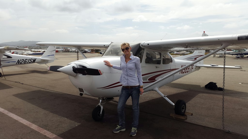
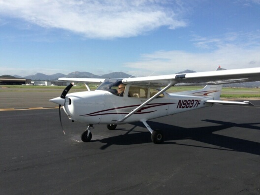
I meant to share this last week, but didn’t get a chance to because I went to Arizona. I went up and did my third solo flight and first solo “out of the pattern” last week. I brought the GoPro along and got this video in my favorite airplane, N9897F, heading out to Bonsall and the Pauma Valley practice area.
My first cross-country flight is scheduled for Monday! I will be flying from my home airport in Carlsbad to William J Fox Airfield (KWJF) in the Antelope Valley – the northern tip of Los Angeles County. I’ve never been to Fox Field and neither has my instructor, so it will be fun to find it using maps, the iPad, GPS, and good ole’ VORS. I’ve been looking forward to cross-country flying since I started and am so excited it is finally happening!
First Solo Flight – March 18, 2015 – Ramona Airport (KRNM)
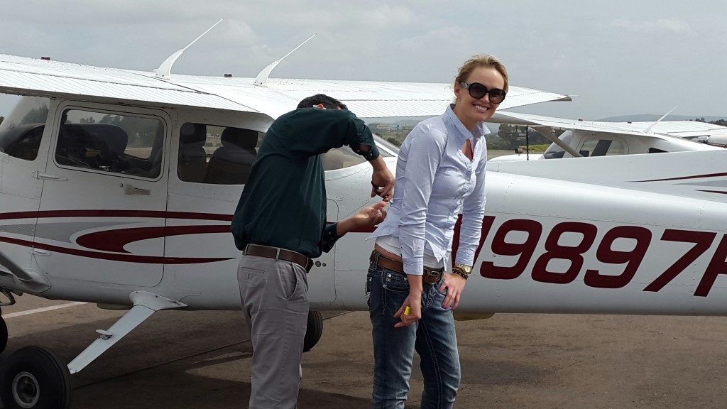
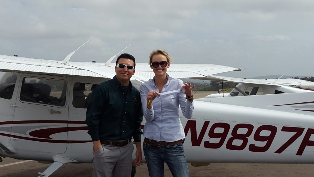
Yesterday, a lifelong dream came true – I flew SOLO for the first time! And not even at my home airport, I did my solo at Ramona! We went there because of the cloud cover at Carlsbad. A solo flight consists of three takeoffs and three landings – and they all went great. I was very nervous but as soon as my instructor Andy hopped out, all the training kicked in and I was able to focus. After we got back to Carlsbad, Andy cut the back of my shirt off, a instructor-student solo pilot tradition. This is only the beginning and I cannot wait to see what the future holds, and share the adventure of aviation with family, friends, and lots of rescued canine passengers.
Inflight Emergencies: Knowing what to do if the engine quits
Tomorrow is my pre-solo stage check, second attempt (second go around). I literally had to “go around” after my first landing at French Valley on the last stage check. I landed hard, and bounced. Fortunately, it wasn’t too disastrous, and the only thing that got hurt was my pride. But it definitely wasn’t a safe landing, and I realized I needed some more practice. I’ve had three lessons with my new CFI Andy, and tomorrow is the redo of the practical test portion. Tonight I’m reviewing maneuvers, stalls, slow flight, landings, and emergency procedures. Basically, I needed to be prepared for everything, because the next step is the solo flight.
Inflight Emergency Engine Failure – the ABC’s
I know from reading my Pilot Operating Handbook / Information Manual, that with proper preflight inspections and maintenance, inflight emergencies caused by aircraft or engine malfunction are extremely rare. Still, it’s important to know what to do, because my life is at stake, as well as the lives of my passengers and people on the ground. It’s easy to recite a list of procedures on the ground, but it’s harder to remember everything when it’s actually happening. That’s why we have acronyms, and checklists.
A=AIRSPEED (Best Glide Speed – 65 KIAS). Pitch and maintain so as to stay aloft as long as possible.
B=BEST LANDING AREA. Look for a safe, flat and level area to land, keeping in mind that it may be underneath you or behind you. Immediately start heading towards that area and commit to it
C= CHECKLIST. This is situation permitting. If you are 500 feet above ground, you may not have time to pull out your checklist. But if you are 4,000 feet in the air, you should attempt an engine restart if possible. I learned to use the “7-UP Checklist”, start at the bottom and think of the shape of the number “7”.
Fuel Shutoff Valve – On
Fuel Selector – Both
Mixture – Full Rich
Throttle – Power Set
Master – On
Aux Fuel Pump – On
Ignition – Start
Assuming the engine does not restart, Squawk 7700 and make a Mayday call on 121.5. Do not add flaps until you know you have the field made. Here is a video that I found helpful:
Managing Risk While Flying – The PAVE and I’M SAFE Checklists
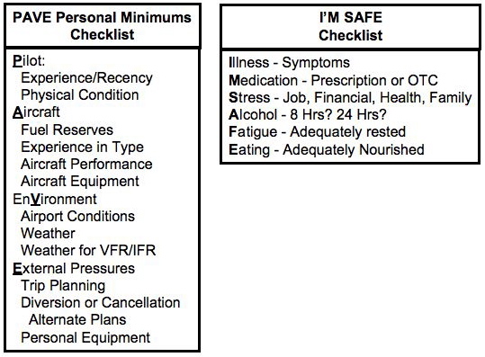
Yesterday, I wrote about Single Pilot Resource Management, one of the first things that I anticipate will be discussed in my upcoming stage check. There are six aspects of SRM, they are task management, automation management, risk management, aeronautical decision making, situational awareness, and controlled flight into terrain awareness. Today, I wanted to review more closely Risk Management, and specifically the PAVE and I’M SAFE Checklists
The FAA and my flight school are big on risk management, and they rightly should be. Many aircraft accidents happen because pilots do not identify risks and are caught off-guard by something that could have been anticipated. The FAA recognizes that two pilots with the same certification might have different levels of experience and comfort, and even though they have the same rights to fly, they should have different personal minimum standards. The PAVE checklist addresses personal minimums.
The I’M SAFE checklist addresses the personal minimums of the pilot. Are you sick, medicated, stressed out, under the influence of alcohol, fatigued or tired, and have you eaten recently. If you are worked up about something, running on zero sleep, starving because you haven’t eaten all day, or sick, you shouldn’t fly. Everytime, it is better to be safe than sorry.
Single Pilot Resource Management ~ The 6 Components You Must Remember
 In my upcoming presolo stage check, one of the first topics I know I will be tested on is Single-Pilot Resource Management. After all, I’m going to have to do this when I solo, so I better know what it is. This is the art and science of managing your resources – all by yourself. Resources can be onboard the aircraft and from outside sources. There are six components of SRM. They are:
Task Management
Automation Management
Risk Management
Aeronautical Decision Making
Situational Awareness
Controlled Flight into Terrain Awareness
 Situational Awareness is taking into consideration all factors such as traffic, weather, fuel state, aircraft mechanical condition, and my own fatigue level that may have an impact on the successful completion of the flight. When I’m flying around, whether it’s local or cross country, I’ve got to manage all the technology in the aircraft as well as radio and navigation tasks. I need to be able to manage risk and make accurate and timely decisions. Sometimes in order to make decisions, I will need to gather information and analyze it. I also need to know what to do in an emergency, such as a radio failure or an engine failure. There might not be one best correct answer as to what to do in a particular situation – or there might be. I’ve got to analyze each situation in light of my experience level, personal minimums, and current physical and mental condition.
In life, I have gotten overwhelmed at a number of stressful situations. If I’m overwhelmed when I’m flying, I could panic and completely and totally forget what to do. I might make the wrong decision or a careless mistake that could put my life or the lives of other innocent people on the ground at risk. Flying is serious business. I’ve got to take it seriously and remain cool as a cucumber and calm under pressure, just as any professional badass pilot would do.
Tomorrow night I will talk more about Risk Management, including the PAVE checklist and the I’M SAFE checklist. So much to remember.
Private Pilot Pre-Solo Stage Check Study Notes
Private Pilot Pre-Solo Stage Check Study Notes
My pre-solo stage check is a week from Monday, and I’ve been studying lots. Here are more questions… and the correct answers.
1. Which Aircraft Has The Right of Way?
A. A Rotorcraft
B. An Aircraft In Distress
C. An Airship
2. Which Best Describes Density Altitude?
A. Pressure Altitude Corrected For Non-Standard Temperature
B. Your Actual Height Above Sea-Level
C. What You Would Read When Your Altimeter Is Set To 29.92
3. How Long Are TAFs Usually Valid For?
A. 48 Hours
B. 8 Hours
C. 24 Hours
Notes: TAF is used as a weather forecast over an area, airport or station predicting and telling the meteorological conditions, such as winds, precipitations, storms, clouds, temperature. The TAF has a valid period of 24 hours and it is updated every 24hours or daily. Therefore, the Information display on the TAF is longer and bigger than the METAR info.
4. What Should You Squawk If You Lose Radio Communications?
A. 7500
B. 7700
C. 7600
5. Which Is NOT a Type of Class E Airspace?
A. Off-Shore
B. WAC (World Aeronautical Chart)
C. Surface
6. Define The Following METAR: KGNV 101439Z 15010G17KT 10SM OVC011 23/21 A2979
A. Metar for the gainesville airport on the 10th at 1439z winds 150 at 10 gusting to 17 with 10sm of visibility. Overcast at 1,100. temp 23 dewpoint 21 altimeter 29.79
B. Metar for the gainesville airport on the 10th at 1439z winds 010 at 15 gusting to 17 with 10sm of visibility. Overcast at 1,100. temp 23 dewpoint 21 altimeter 29.79
C. Metar for the gainesville airport on the 10th at 1439z winds 150 at 10 gusting to 17 with 10sm of visibility. Overcast at 11,000. temp 23 dewpoint 21 altimeter 29.79
7. Which is NOT a Characteristic of an Aft CG?
A. Lower Stall Speed
B. Higher Cruise Speed
C. More Stable
8. What is VOR an Acronym For?
A. Vertical Orientation Route
B. Very High Frequency Omni-Range
C. Victor and Obstacle Readings
9. When Do You NOT Need a Mode C Transponder?
A. Above Class C Airspace
B. Below Class C Airspace
C. Inside Class C Airspace
10. What is Calibrated Airspeed (CAS)?
A. Indicated Airspeed Corrected For Installation and Instrument Error
B. The Actual Speed of Your Aircraft Through The Air
C. The Airspeed Read Directly Off The Indicator
Private Pilot Exam Practice Quiz #1 :: Aerodynamics
[slickquiz id=1]


